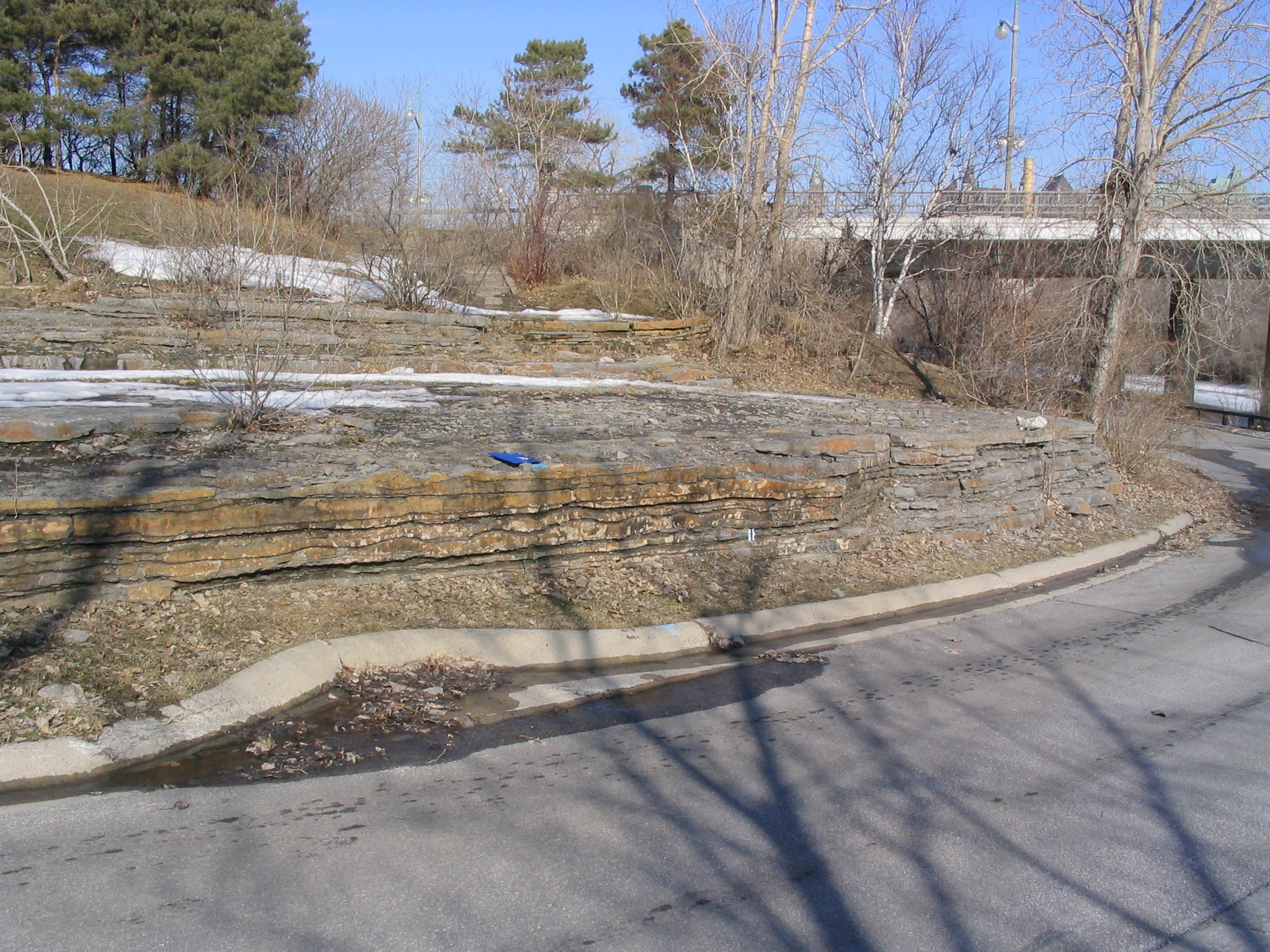
13. Victoria Island
Dune bedforms and fossiliferous limestone
Victoria Island
Middle Street, on Victoria Island, as it passes under Portage Bridge, Ottawa. Access from Chaudières Bridge.
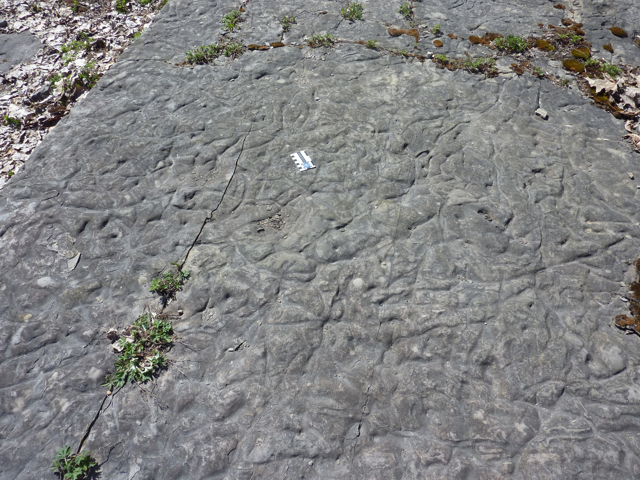
Undulating dune bedforms in Ottawa Group limestone, Victoria Island, Ottawa.
Photo by Q. Gall.
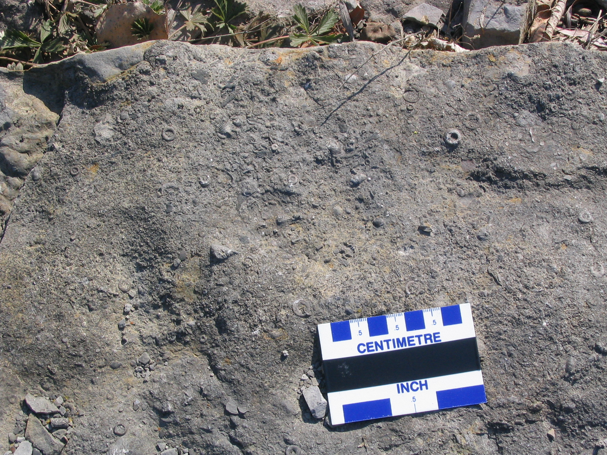
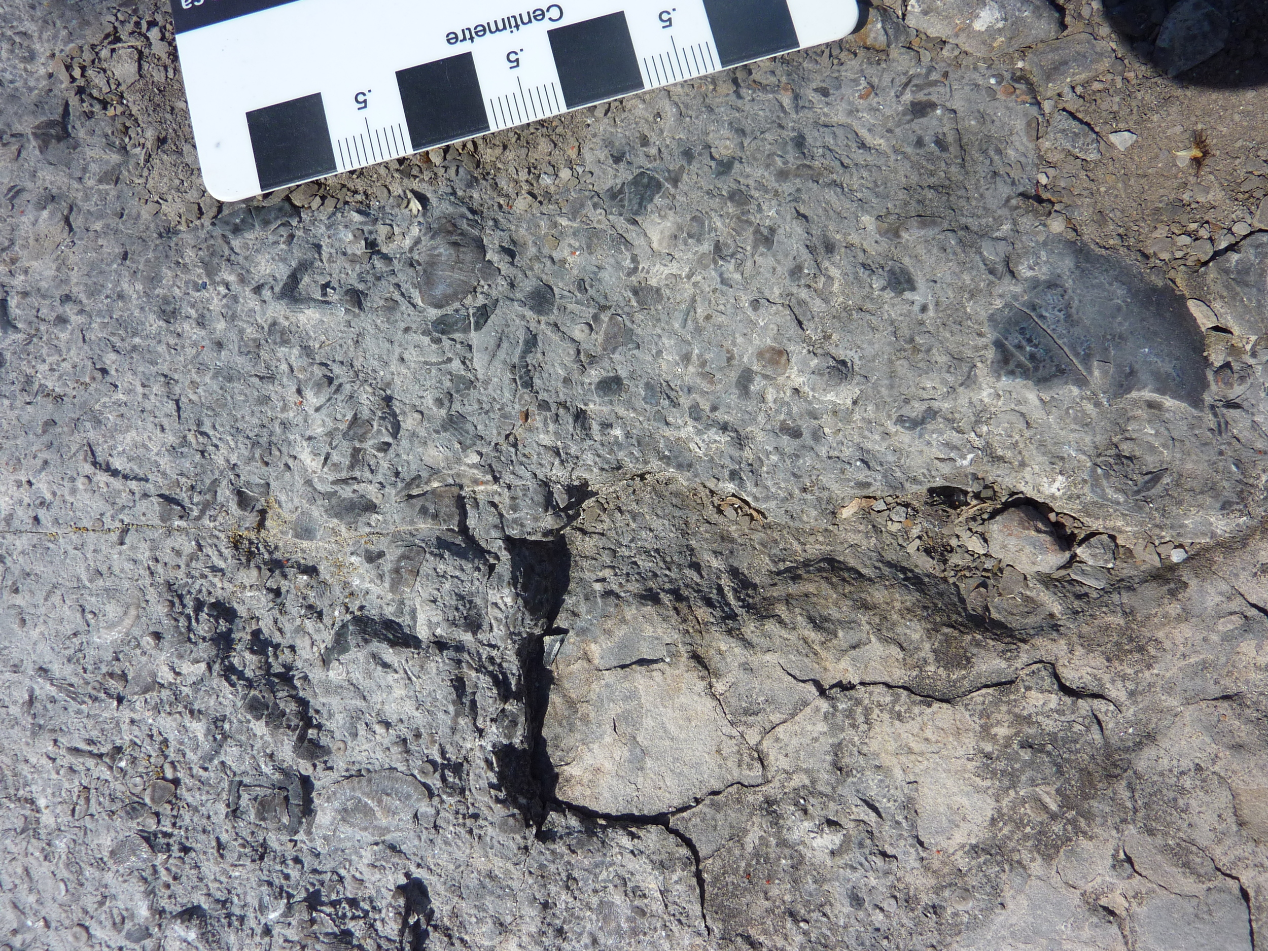
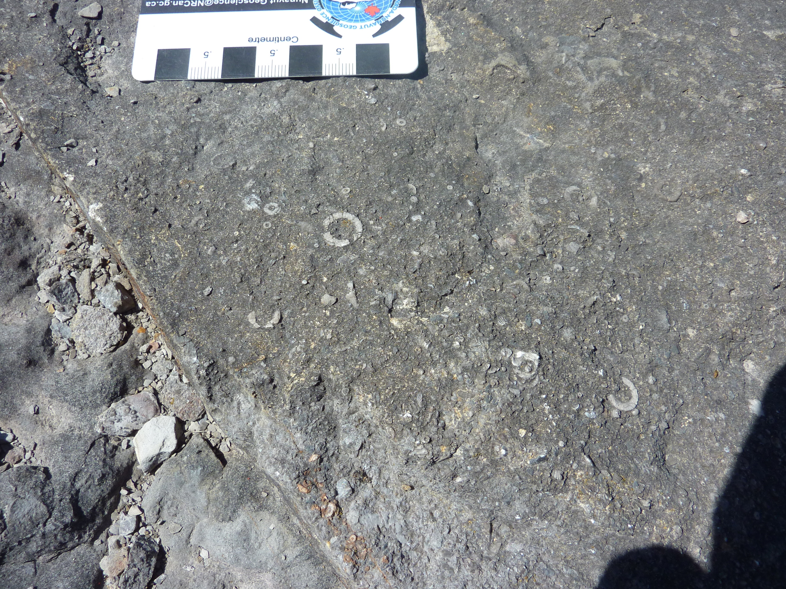
These outcrops are Ottawa Group fossiliferous limestone, which contain dune-scale bedforms (megaripples; >4 cm amplitude). The vertical section of the outcrops on either side of the road, show alternation between limestone beds containing abundant fossil fragments (brachiopods, bryozoa, orthocone cephalopods and crinoids) and dunes, and limestone beds that are flat-lying and contain abundant feeding burrows and trails (trace fossils). Crossbedding and stylolites (non-structural fractures) are locally prominent, as are desiccation cracks.
One interpretation of the bedding style alternation may be that it reflects environment changes between stormy periods (sediment and fragmented fossil transportation by dunes along the sea floor) and calmer, 'fair weather' periods with little sediment transportation and more feeding by benthic animals. Occasional mudcracks in the vertical section indicate periodic exposure, resulting in desiccation of the limy sediment. It is also possible that the changing character of the limestone beds reflects periodic rising (deepening) and falling (shallowing) of sea level. The beds that are rich in trace fossils and few dunes, may reflect a deeper water quiet environment that was below normal 'fair weather' wave base.