Ottawa Gatineau Geoheritage

The Ottawa-Gatineau Geoheritage Project promotes greater public knowledge and appreciation of the geology and related landscapes in and around Canada's National Capital Region

6. OC Transitway at Roosevelt Ave

Stromatolite fossils in cross-section

North wall of the OC Transitway

Footbridge over OC Transitway at Roosevelt Ave., Ottawa, Ont.


Flat-lying stromatolite unit exposed along the OC transitway north and south wall between Churchill Ave. and the Sir J.A. Macdonald Parkway

Stromatolites are biosedimentary structures built up during sedimentation by cyanobacteria. Layers were built up as the cyanobacteria grew up through successive depositions of lime muds to create rounded, domed structures. The limestone wall of the Transitway bedrock shows vertical cross-sections through these fossils. Gull River Formation.

Stromatolites can also be seen in plain view near the Québec side of the Champlain Bridge.

Stromatolite laminae

5. Westboro Beach

Stromatolites, orthocones and trace fossils fossils

Westboro Beach

Kitchissippi Lookout parking lot, off Ottawa River Parkway, Ottawa, Ont.

Stromatolites seen in cross-section, Westboro Beach.

Photo by Q. Gall.

Section of Gull River Formation limestone at Westboro Beach. Stromatolites can be found in the bushes at the top of the section

Photo by Q. Gall.

Stromatolites are biosedimentary structures built up during sedimentation by cyanobacteria. Layers were built up as the cyanobacteria grew up through successive depositions of lime muds to create rounded, domed structures. At Westboro Beach, the bedrock shows vertical cross-sections through these fossils. The fossils here are lined up with those seen in plain view near the Québec side of the Champlain Bridge.

4. Champlain Bridge

Stromatolite fossils in plaIn view

Champlain Bridge

Blvd. Lucerne, 175 m west of Champlain Bridge, Gatineau, PQ. From the parking lot, follow the sidewalk along the river back towards the bridge.

Overview of domal stromatolites upstream of Champlain Bridge, Que.

Photo by Q.Gall

Note: only accessible during times of low water level of the Ottawa River.

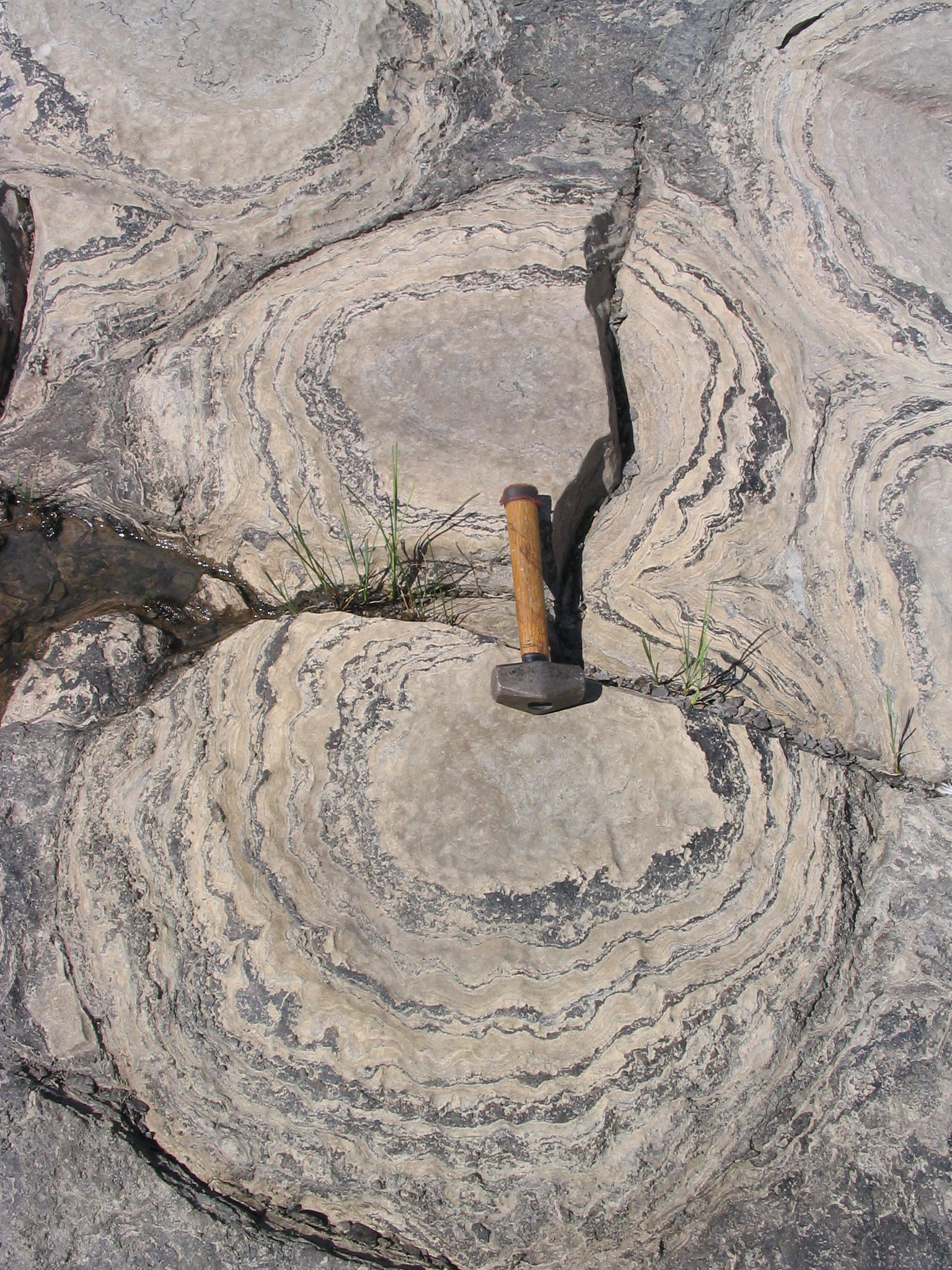
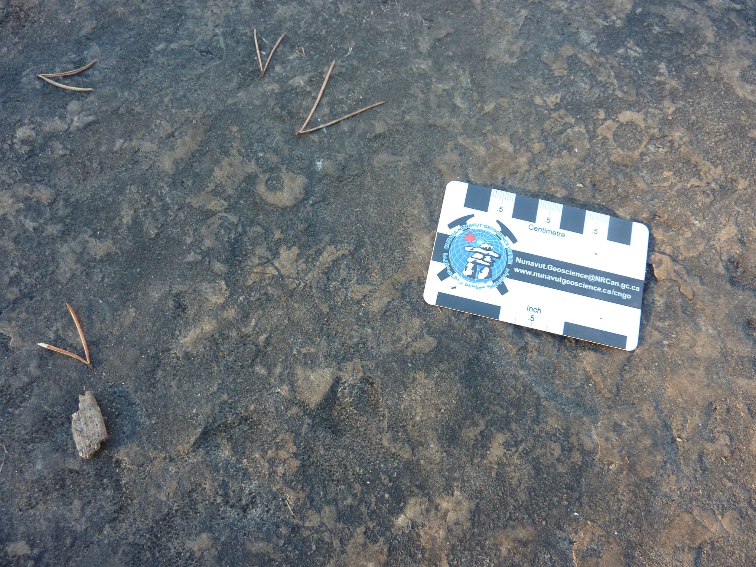
The section of the Ottawa River between Pembroke and Ottawa offers the most easily accessible displays of stromatolites in Canada. Stromatolites are biosedimentary structures built up during sedimentation by cyanobacteria. Through their life processes, such as photosynthesis, cyanobacteria were likely responsible for transforming the Earth's initially reducing atmosphere (oxygen-poor) to its present oxygen-rich state. Layers were built up as the cyanobacteria grew up through the successive depositions of sediment to create rounded, domed structures.

Although they were the predominant life form on Earth for over 2 billion years, stromatolites now live in abundance in only a few localities worldwide. One of these places is Shark Bay, Australia, where hypersaline conditions (more than 3 times the salt content of normal marine water) present an essentially scavenger-free environment that has enabled stromatolites to develop in profusion in subtidal, intertidal and supratidal zones.

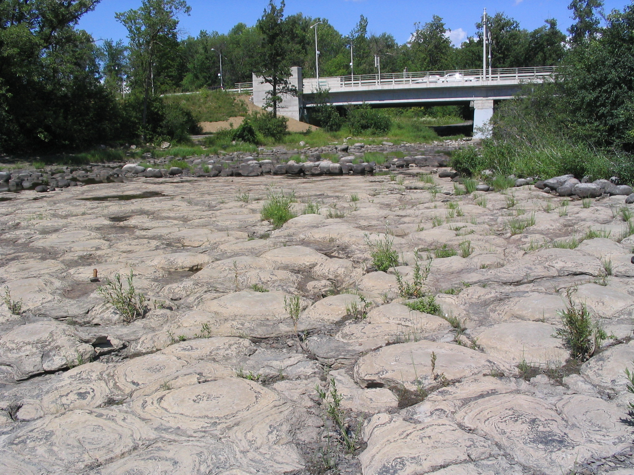
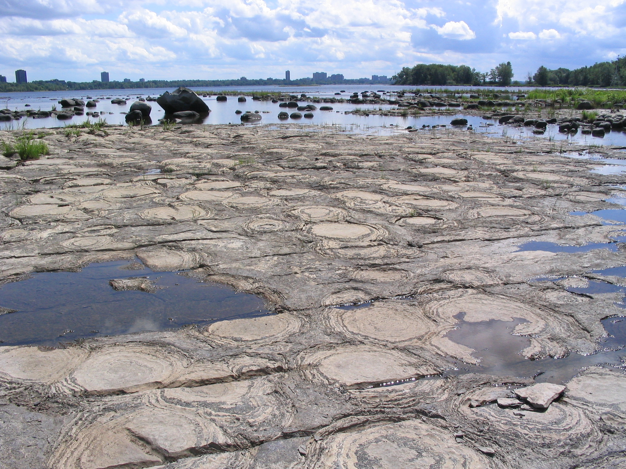
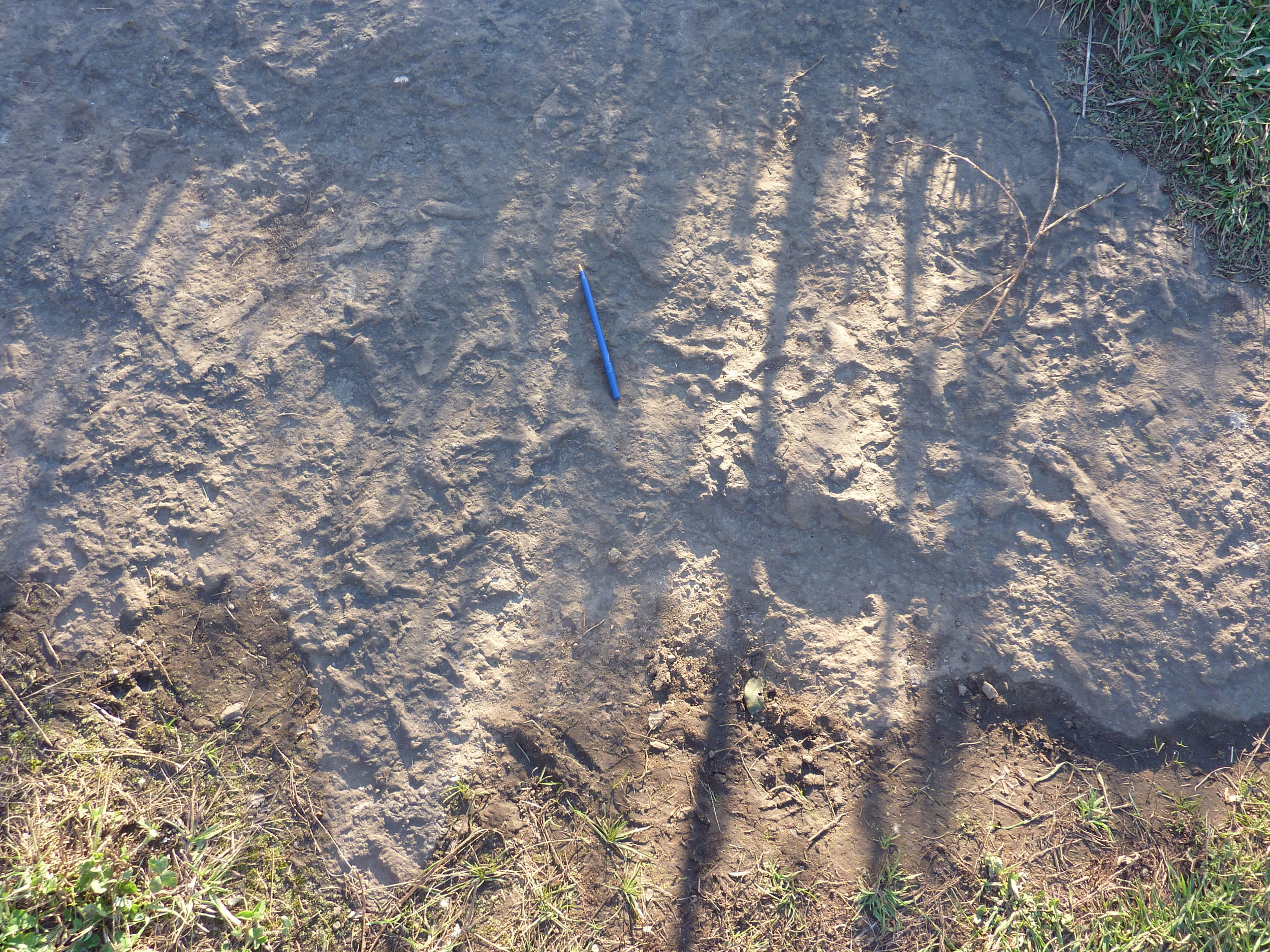
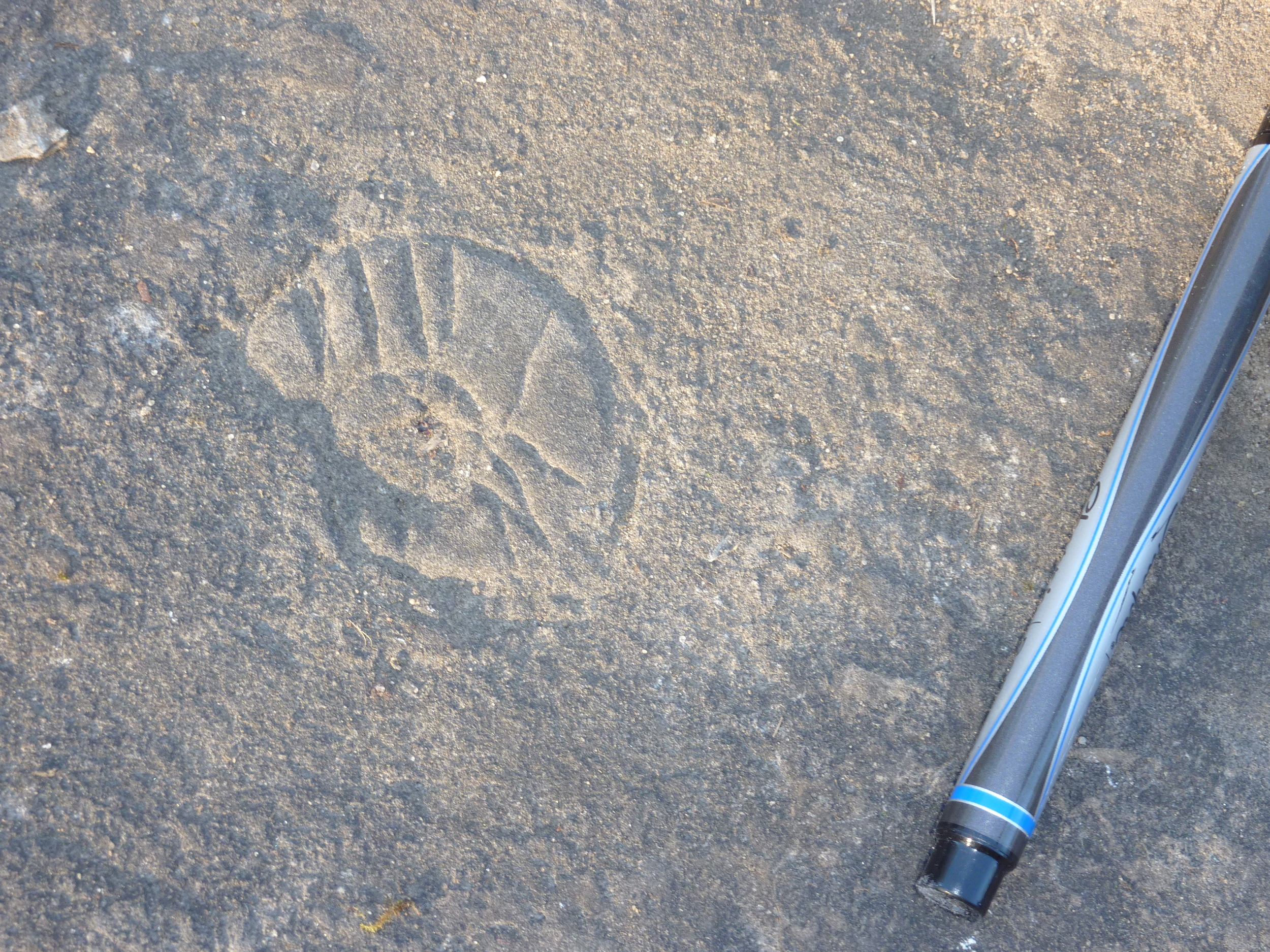
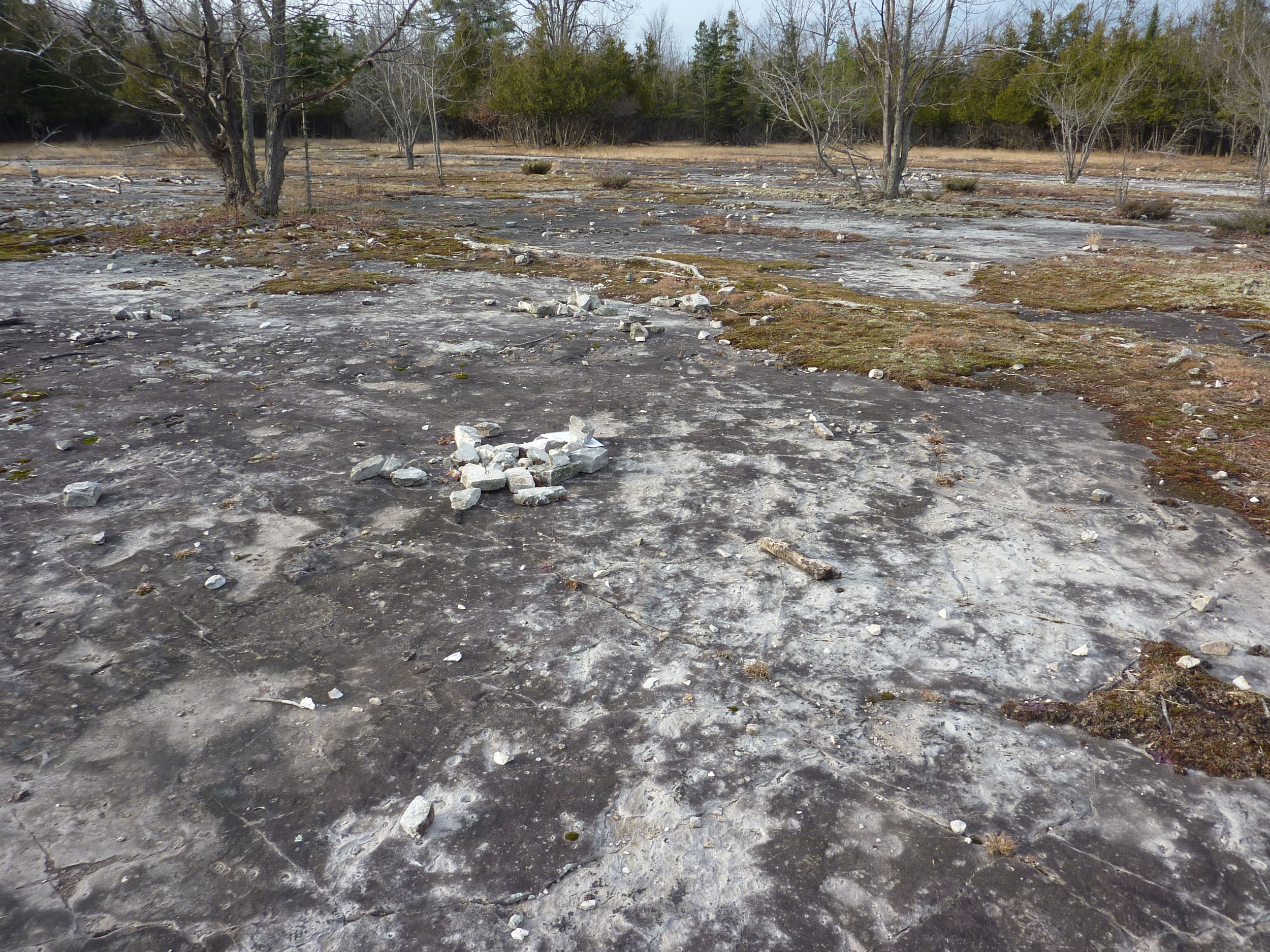
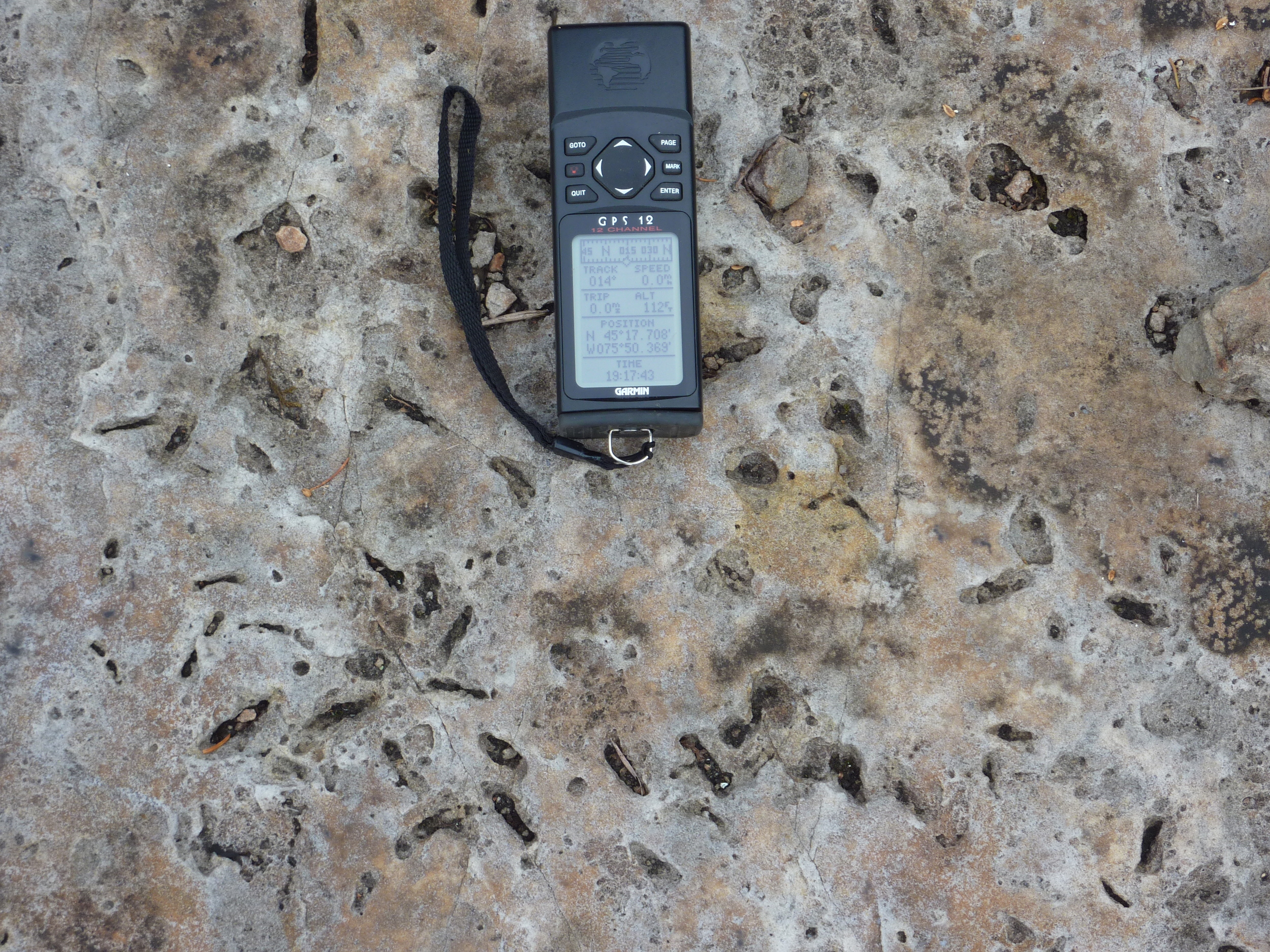
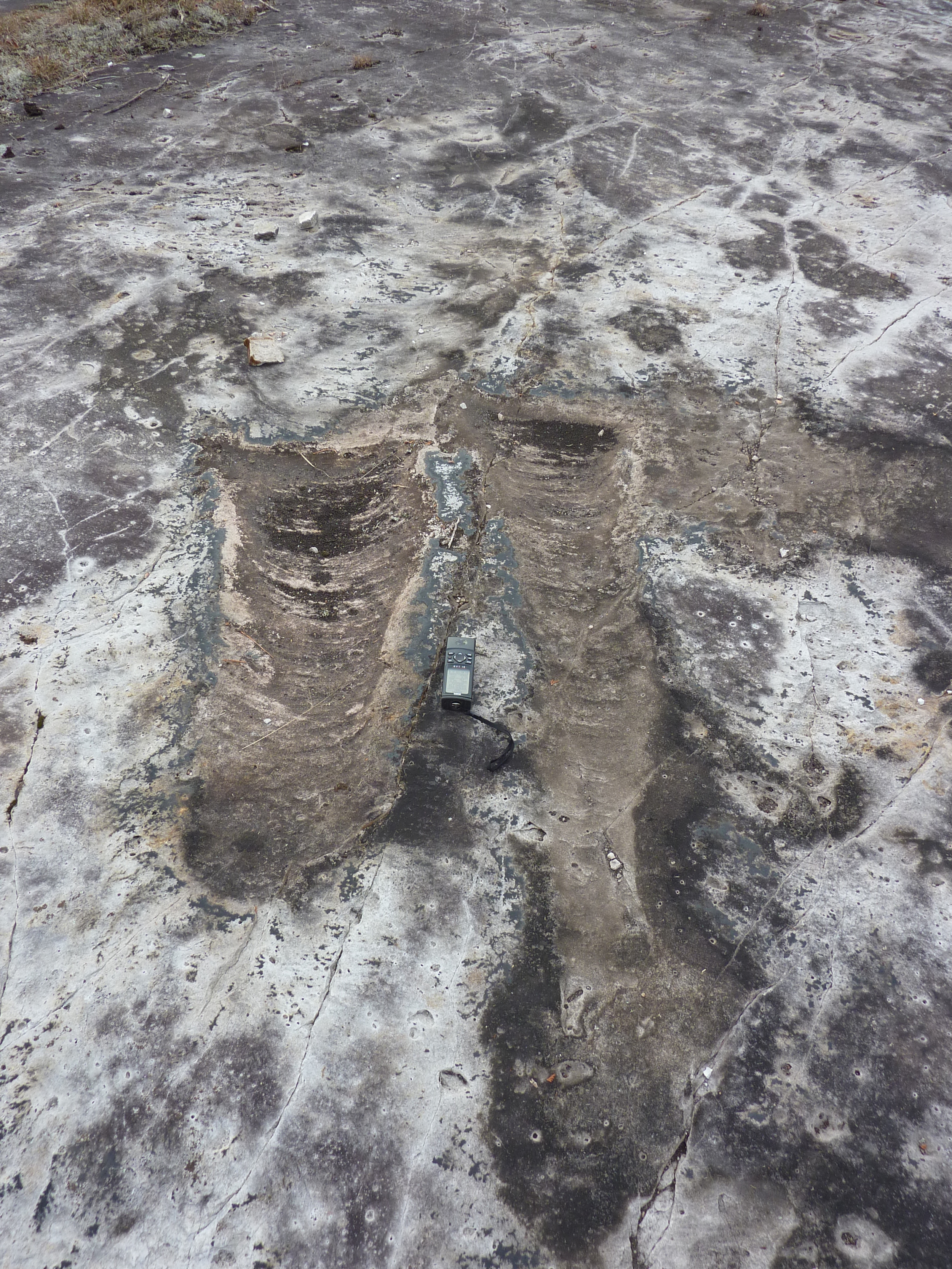
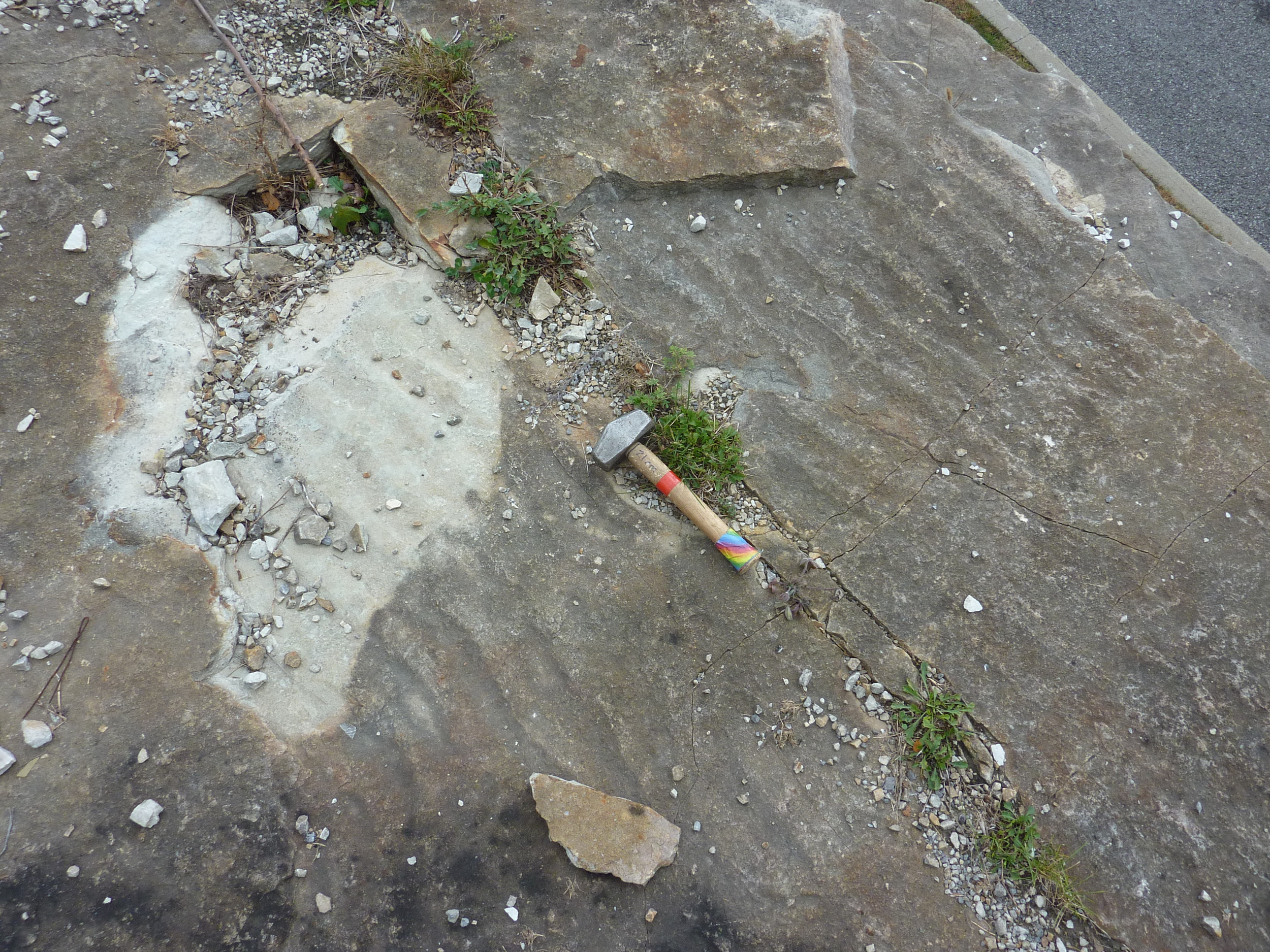
The most spectacular place to view stromatolites can be found less than 100 m upstream from Champlain Bridge. (Go to the first parking lot, west of the bridge, on Boulevard Lucerne /Lower Aylmer Rd.) During low water stages at this site (generally from mid-August to October), a platform of continuous exposure exceeds an area of more than 1500 m2. These stromatolites are arrayed in parallel, locally coalesced north-south lines. Some patches of smaller stromatolites show a distinct east-west elongation, and this, together with associated ripple marks, suggests the influence of longshore currents in a shallow-water warm saline environment, about 460 million years ago. The planar bedding-parallel surface in which concentric laminations of the stromatolites are well displayed was at first thought to be a glaciated surface, but discovery of desiccation patterns on such surfaces and salt casts in some stromatolites indicates a stressed environment. Although abundant in the underlying beds, gastropods are extremely rare in the Champlain Bridge stromatolite biostrome, suggesting that paucity of grazers allowed prolific stromatolite growth, probably in a hypersaline environment. Outward stellate patterns on many biofilm surfaces may have been created by the growth of evaporite crystals before lithification of the biofilm-trapped lime muds.

Boulders of Precambrian granite and gneiss scattered on the limestone surface are glacial erratics from the last glaciation.

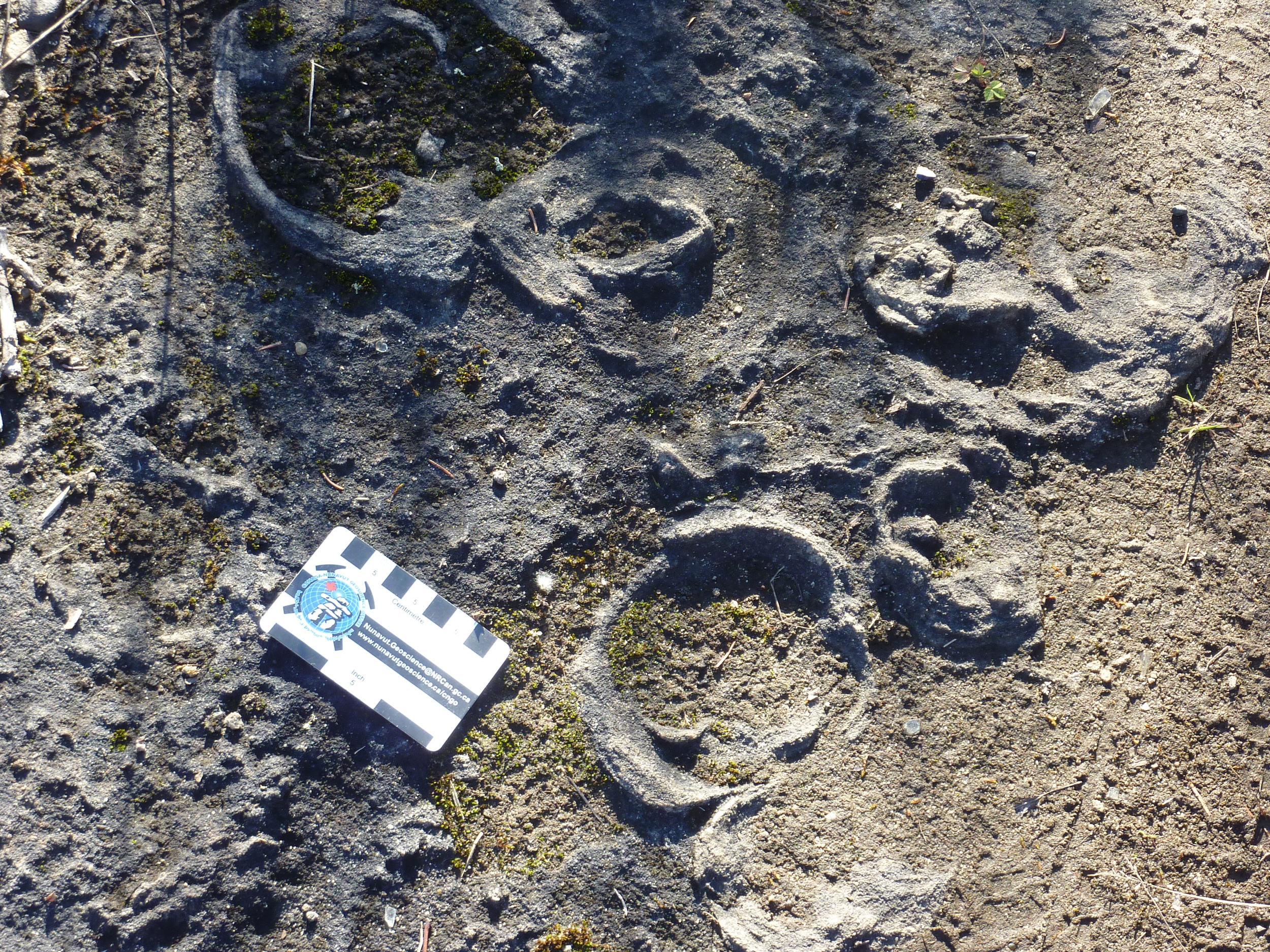
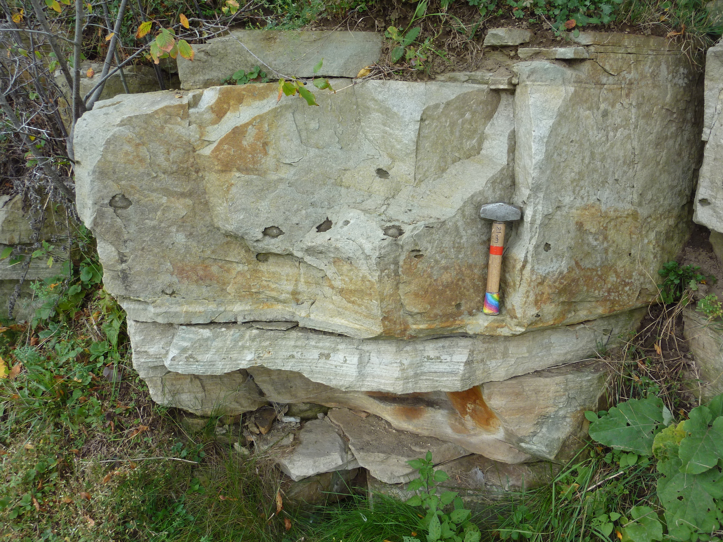
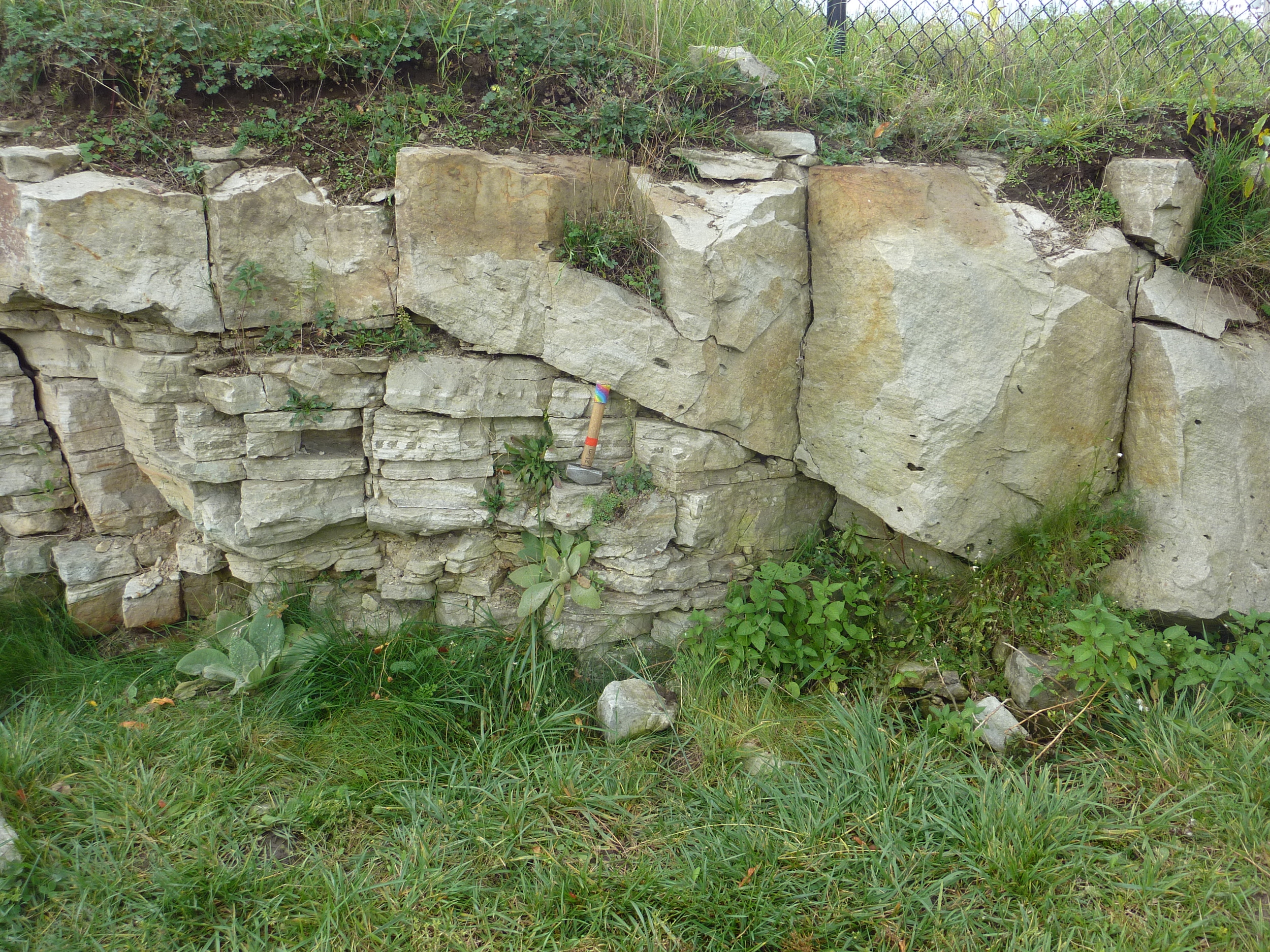
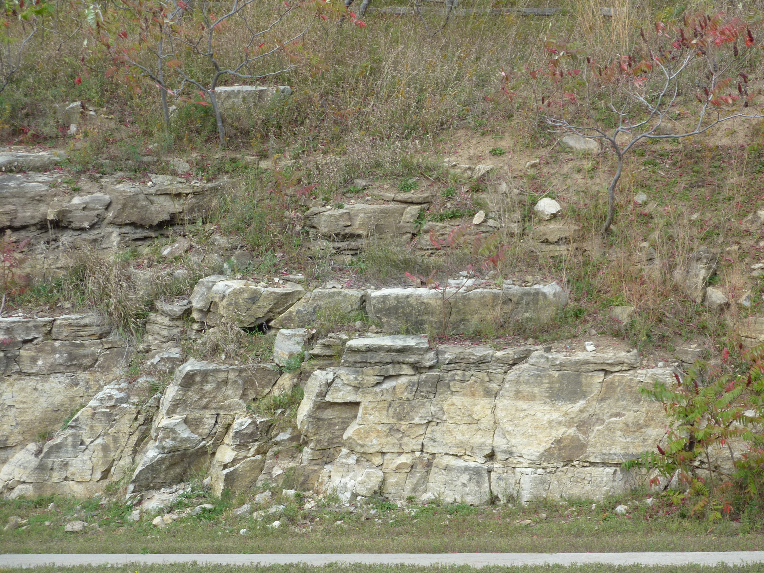
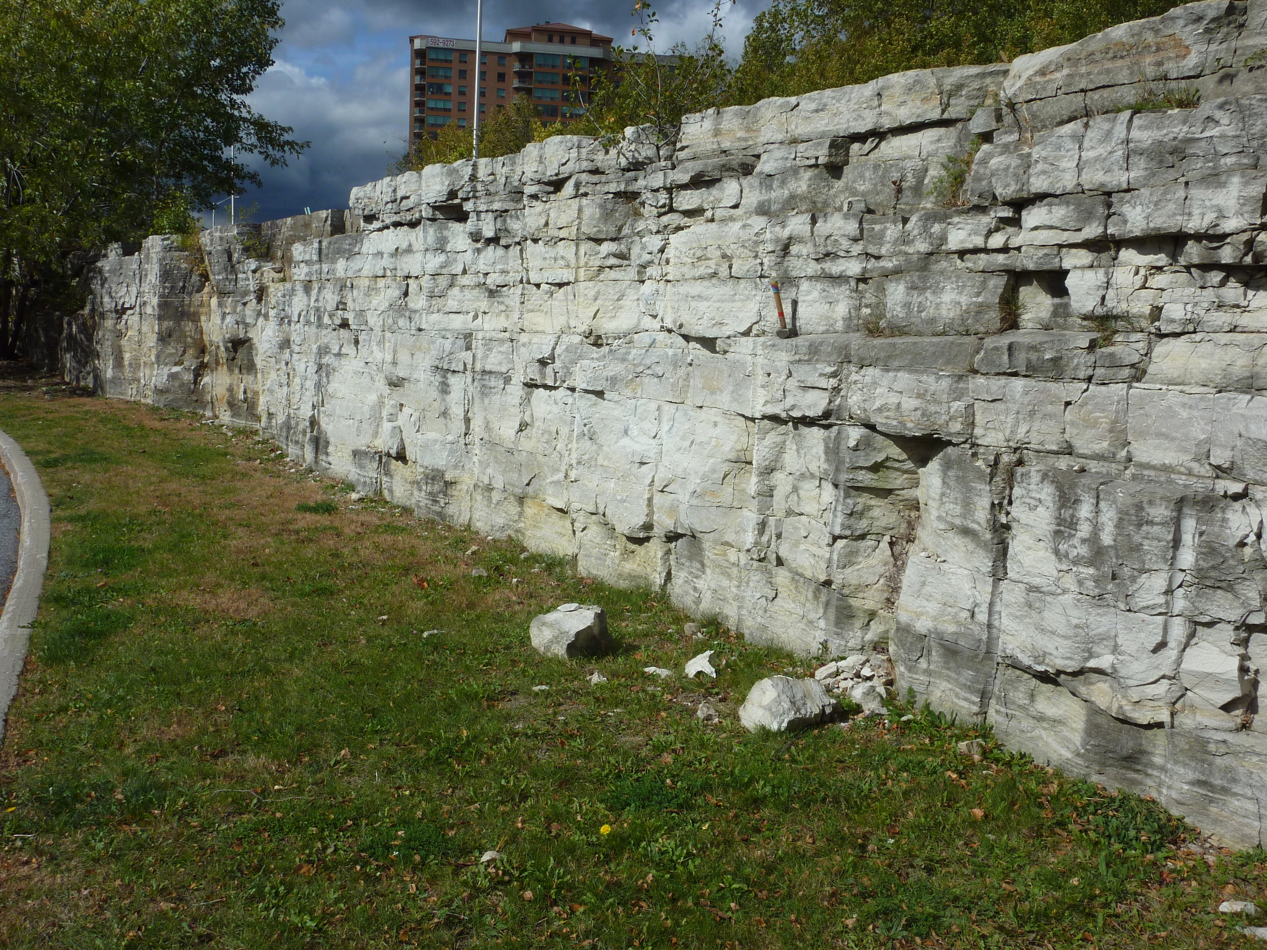
(Note: Cross-sectional views of stromatolites can be seen at Westboro Beach and in the rock wall of the nearby OC Transitway west of Churchill Ave.)

3. Stony Swamp Conservation Area

Sedimentary structures in Paleozoic strata

Stony Swamp Conservation Area

Richmond Rd., 0.75 km south of Hunt Club Rd., Ottawa, Ont


Nepean Formation, Rideau Trail - Stony Swamp Conservation Area.

Photo by Q.Gall

Park below the transmission lines in the lot marked P6. Follow the path and boardwalk westward to an open expanse of flat-lying white bedrock.

Cambrian-Ordovician sandstone in plain view and glacial erosion.

This large outcrop offers an extensive exposure of a single bedding surface of the quartz-rich sandstone typical of the Nepean Formation. The outcrop surface is sub-divided by prominent sets of joints. Loose blocky slabs provide a view of composition, texture and parallel laminations (bedding) in the third dimension.

The sandstone beds are still in their original, horizontal position. The sandstone is composed almost entirely of well-sorted sand-size quartz grains that are cemented by quartz cement. The framework grains are very well rounded and highly spherical. Bedding is marked by slight grain-size and colour differences.

Gastropod in March Formation, Jack Pine Trail - Stony Swamp Conservation Area.

Photo by Q.Gall

The sand was likely deposited in a shallow braided river environment, approximately 500 million years ago. Abundant sets of trough crossbedding can be seen as arcuate traces on the surface (troughs open down-current to the south). These, and the asymmetric ripple marks seen on bedding, indicate that, during deposition, paleocurrents were moving the unconsolidated sand southward. Occasional sets of symmetric ripple marks show trends essentially perpendicular to the current flow direction and may be shore-parallel. The presence in the sandstone of a few elongate crystal pseudomorphs (a mineral with the crystalline form of another mineral rather than its usual form), which are interpreted to have been gypsum (hydrated calcium-sulphate), suggests that the environment may have had a marine influence, or that the depositional waters may have occasionally become alkaline.

A prominent and consistent pattern of joints subdivide the outcrop surface, which also displays abundant evidence of Pleistocene glaciation. Many top surfaces have been polished smooth by glaciation. Nested arcuate chatter marks and glacial striations parallel to the axes of the chattermarks both indicate that the ice was moving southward in this area. The former are a series of small, closely spaced, crescentic grooves chipped in the bedrock by rock pieces held in the moving ice. The horns of the crescent generally point towards the down ice direction. Glacial striations, also known as striae, are parallel linear grooves that were carved in the bedrock by rock pieces frozen into the glacier.

2. Centrum Parking Lot

Section through Nepean and March Formations' sandstones and dolostones

Centrum Parking Lot

Kanata Ave. and Earl Grey Dr., Kanata, Ont.

Nepean Sandstone outcrop behind Walmart Store, Centrum Plaza, Kanata.

Photo by Q. Gall

The outcrop provides a vertical section of the upper part of the Nepean Formation (sandstone) passing into the basal part of the overlying March Formation (top of outcrops). The few metres of vertical section at this stop record thousands of years of sand deposition during the late Cambrian to early Ordovician, which was followed by burial and subsequent lithification and uplift.

The lower section is exposed behind WalMart and also below the southeast corner of the Earl Grey intersection. Here, the quartz-rich sandstone of the Nepean Formation displays abundant cross beds formed by the migration of subaqueous dunes during sand deposition. Joints (fractures) in the section provide a three-dimensional view of some of the cross beds, making it possible to determine the paleocurrent flow direction. Several joint faces are covered with oxidized crystals of marcasite, a polymorph of pyrite. At the top of the lower section, some ripple marks can be seen, and a few, millimetre-scale circular depressions interpreted as ancient rainprint marks.

Transition from Nepean Formation sandstone to March Formation dolomite beds (darker), east side of Kanata Dr. at Centrum Plaza.

Photo by Q. Gall

The Nepean sandstone is extensively used as a building and/or decorative stone on many of our prominent buildings (parliament buildings) and older homes in the Ottawa area.

(Note: The Nepean sandstone also outcrops along Hwy 417 at the Terry Fox overpass and also between Eagleson and Moodie Drive.)

Across the road, on the east side of Kanata Ave., is the transition into the March Formation that overlies the Nepean Formation. The outcrop has dolomitic carbonate beds as well as quartz-rich sandstone beds. Some fossil fragments are found in the dolomitic beds. The sandstone shows ripple marks, cross bedding and dewatering structures (features formed when waters escape sometime following deposition dish-, pillar- and pipe- shaped features formed as water escapes during consolidation of coarse sediments). The beds are tilted westward on the east side of the road, but are nearly horizontal on the west side. This relationship appears to be due in part to draping of the sandstone beds against an 'island' of Precambrian 'basement' rock to the east. The paved path above the staircase is bordered by numerous outcrops of Grenville gneiss and granite.

1. W. Erskine Johnston Elementary School

Glacially sculpted Precambrian gneiss that displays foliation, folds and cross-cutting dykes 

W. Erskine Johnston Elementary School

50 Varley Dr., Kanata, Ont.

Precambrian gneiss shaped by glacial erosion. W. Erskine Johnston Elementary School, Kanata, On. 

Photo by J. Aylsworth

Several glacially scoured outcrops of Precambrian gneiss (metamorphic rock) are exposed just beside the school's temporary classroom buildings. The Precambrian gneiss belongs to the Grenville Province of the Canadian Shield, is over 1 billion years old, and represents the oldest exposed rocks in the Ottawa area (often referred to as "basement' rocks" to the younger Paleozoic rock and Quaternary sediment, which have been eroded from this particular area). These rocks, and those of the Gatineau hills in Québec, represent the 'roots' of an ancient mountain system that was once as impressive as the Himalayan Mountains today. One billion years of erosion have gradually destroyed these mountains, leaving the bedrock of their 'roots' exposed. The school is located on the southeastern end of the Carp Ridge - a fault-bounded block that exposes Precambrian rocks that have moved upward relative to the Paleozoic rock elsewhere under Ottawa.

The current shape of the outcrop is the result of glacial erosion during the last ice age. Abrasion and plucking of the bedrock surface under the moving ice sheet has produced a classic glacial landform known as a roche moutonnée. These landforms have a smooth sloping, up-ice side (result of abrasion), and steep, irregular, down-ice side (result of plucking), which indicates southward movement of the Pleistocene ice at this locality.

The coarse-grained gneiss displays a metamorphic layering (foliation) along which the minerals are aligned. Gneiss mineralogy includes quartz, feldspar, mica, hornblende and garnet. The foliation has been folded during deformation of the gneiss, which has also caused some minerals to recrystallize and grow parallel to the fold axes (= mineral lineation). Also evident in the outcrops, are coarse-grained pegmatite dykes of igneous origin (mainly granite, consisting of quartz and alkali feldspar), which cut across the gneissic foliation. These cross-cutting, intruding relationships indicate that the dykes formed after deformation of the gneiss. There are also a few finer-textured dykes of aplite (sugary-textured granite) and diorite composition (dark grey due to more mafic minerals).